Mesopotamia Map Printable (Free Activity!)
Explore the birthplace of civilization with this free Mesopotamia map printable! This simple geography activity helps kids visualize where ancient Mesopotamia was located and understand why its rivers made it the perfect place for early farming and cities to grow. It’s an engaging way to introduce world history through a hands-on Mesopotamia map worksheet for kids.
Sometimes history feels far away for younger learners, but seeing it on a map helps it all come to life. This ancient Mesopotamia map printable gives kids a chance to connect geography, science, and reading comprehension in one activity. History lessons like this are also a wonderful way to build reading comprehension skills, kids learn to read for meaning as they explore maps and stories of ancient life.
You can even pair this activity with our Fertile Crescent Reading Comprehension Worksheet for a complete cross-curricular lesson that blends geography, history, science, and literacy all in one engaging activity. Instead of memorizing dates or lists of kings, they’ll start to see how rivers, land, and environment shaped one of the first great civilizations.
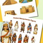
Be sure to grab some of our printable Mesopotamian cut out figures to, to go along with this activity.
Whether you’re a homeschool parent or a classroom teacher, this Mesopotamia map worksheet is a great way to introduce the Fertile Crescent, the Tigris and Euphrates Rivers, and how geography helped shape society itself.
📌 Tip for homeschoolers: Focus on big ideas – how people used natural resources, how geography influenced inventions like irrigation, and how communities form around shared needs. These concepts build a strong foundation for understanding all of world history later on.
✂️ Materials
- Our free Mesopotamia Map Printable PDF (grab it below!)
- Colored pencils or crayons
- Optional: globe or world map for comparison
- Optional: laminated copy for reuse
📄 The Printable Maps
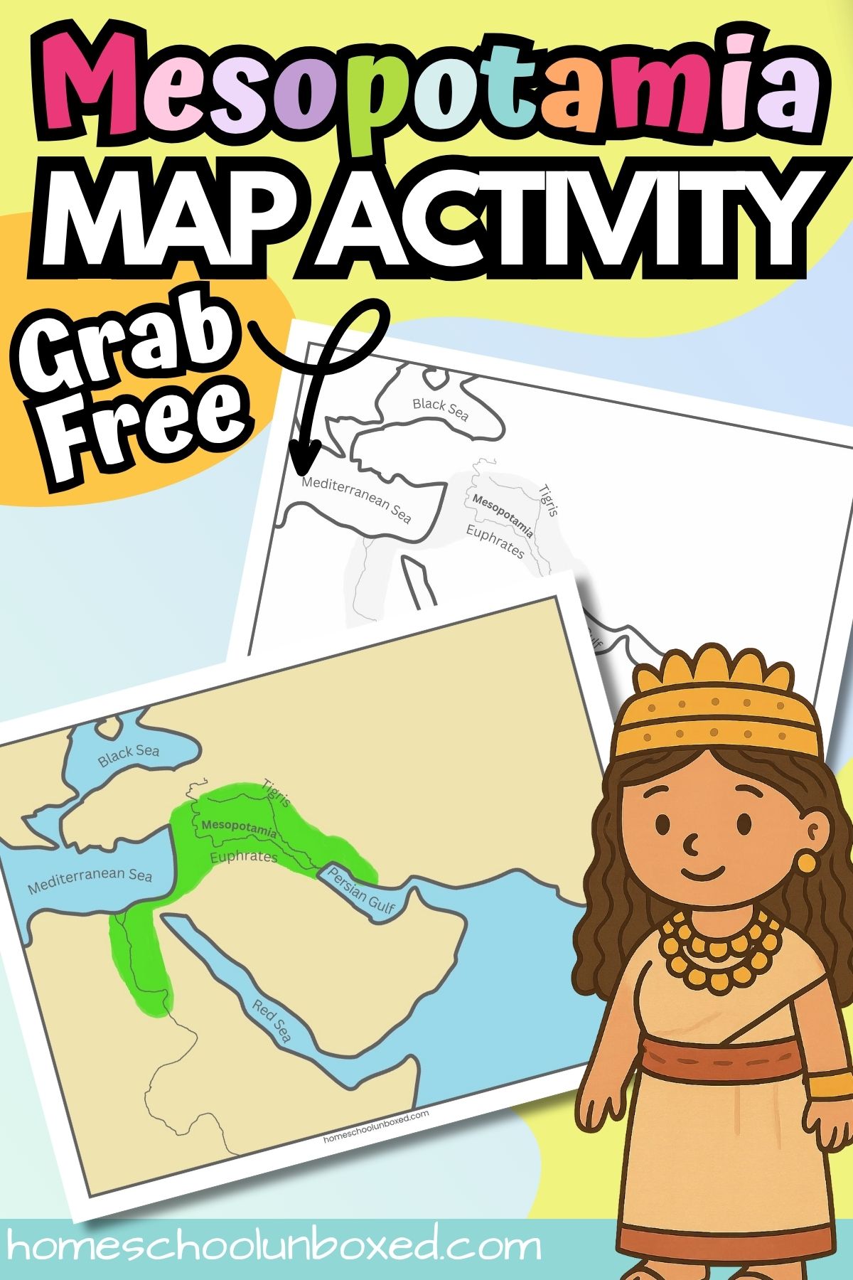
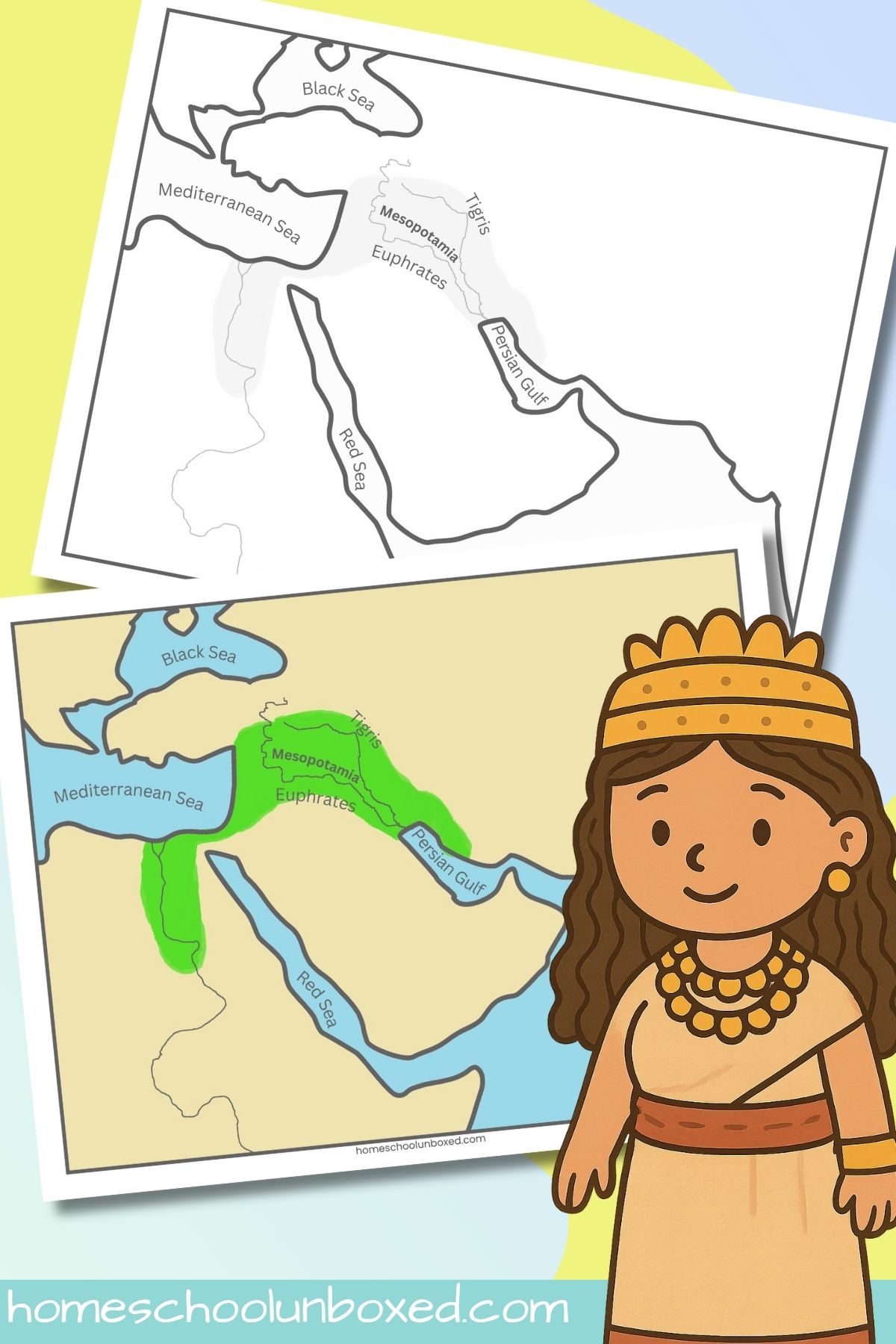
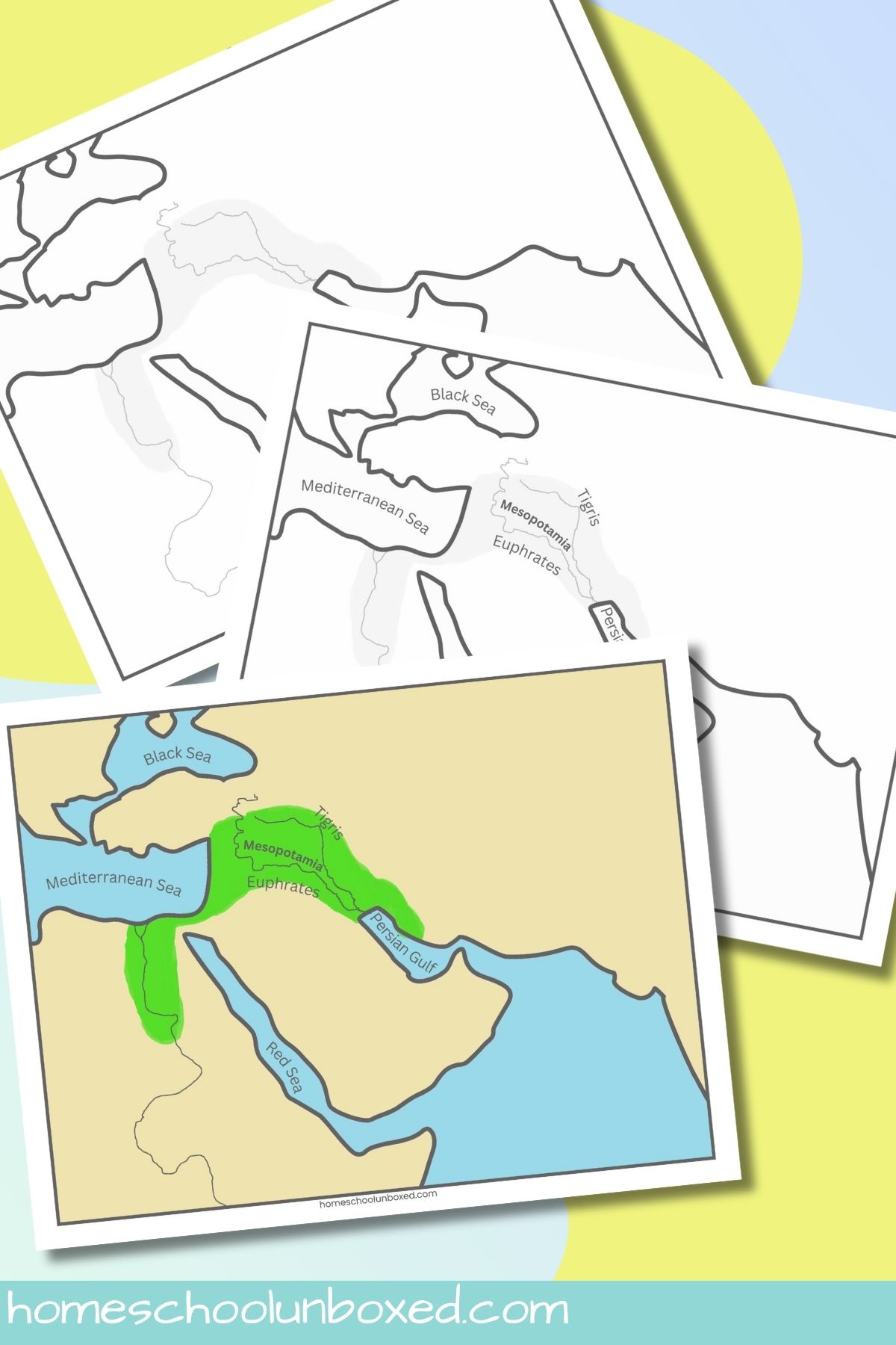
This printable PDF download includes 3 separate maps of Mesopotamia:
- A color map showing Mesopotamia within the Fertile Crescent
- A labeled outline map (great for guided learning)
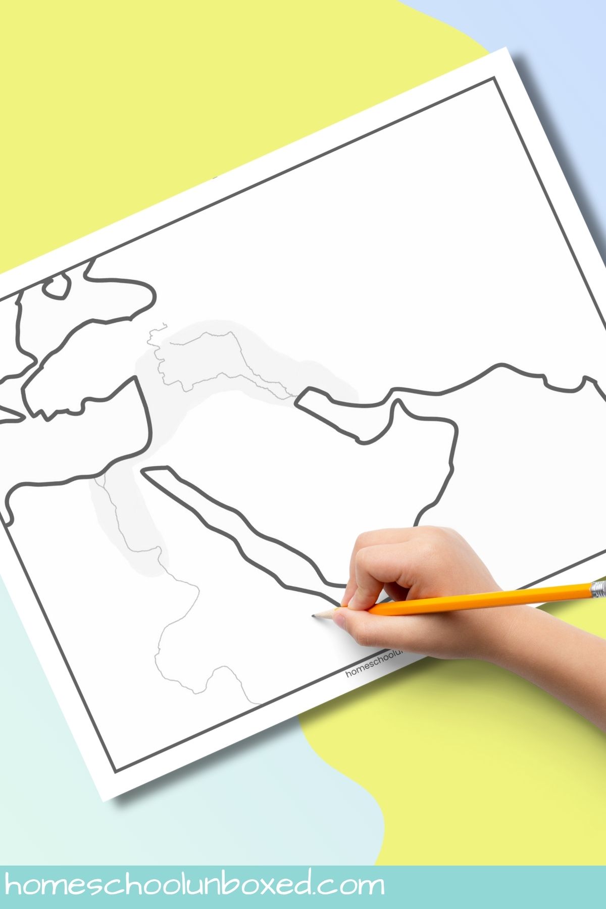
- A blank Mesopotamia map worksheet (perfect for labeling practice or quizzes)
All maps clearly mark the Tigris and Euphrates Rivers, Persian Gulf, Mediterranean Sea, and surrounding regions for easy reference. It’s the perfect addition to your ancient civilizations unit study or homeschool geography lessons.
🧠 How to Use the Maps
Before starting, make sure to print out both the labeled and blank Mesopotamia map worksheets. Use the blank one as an interactive tool. Have kids label key features such as the Tigris and Euphrates Rivers, Persian Gulf, Mediterranean Sea, and Fertile Crescent region.
As they label, talk about what each feature meant to the people who lived there: rivers as life sources, seas as trade routes, and fertile plains as farming hubs. These discussions deepen understanding of how geography influenced daily life and community growth. This turns simple labeling into meaningful discussion, helping kids connect geography to real human experiences.
Start by locating Mesopotamia on a globe or modern world map. Help kids notice that it lies between two major rivers, the Tigris and Euphrates, in what is now Iraq and parts of Syria and Kuwait. Point out that this area is in the Middle East, close to where Africa, Asia, and Europe meet. This helps children understand that it was a crossroads for early trade and culture.

Next, compare the ancient Mesopotamia map printable to modern geography. Ask questions like:
- “What seas surround this area?” (The Mediterranean Sea, Red Sea, and Persian Gulf.)
- “Why might people want to live near rivers?” (Access to water for drinking, farming, and transportation.)
- “What might happen if the rivers flooded?” (It would make the soil fertile but could also destroy crops or homes.)
Encourage kids to color the green Fertile Crescent area and label the rivers, seas, and region names. As they do, talk about how geography made life possible—how farming began here, how people built canals to control water, and how this led to the first cities.
💬 Teaching Tip: The goal isn’t to memorize every name—it’s to understand why Mesopotamia mattered. Talking through these questions helps kids see how geography connects to survival, invention, and community building.
To wrap up, invite your kids to compare Mesopotamia to where you live now. Ask: “Do we have rivers nearby? How do we use them?” This helps them link ancient history to real-world geography and understand the bigger picture of how people adapt to their environment.
📖 Educational Uses & Tips
✏️ Skill Reinforcement: Use the blank Mesopotamia map printable to review geography terms while practicing handwriting or labeling.
🌐 Cross-Curricular Links: Tie it into science by exploring how rivers create fertile soil, or into language arts with reading comprehension about early civilizations.
🎨 Hands-On Extensions: Have kids create a mini “civilization” drawing around the rivers—adding farms, temples, or homes.
💡 Challenge Option: Older students can research and label early city-states like Ur, Uruk, and Babylon.
📌 Homeschool Tip: Don’t worry about perfection, focus on understanding the connection between land, water, and community. This is what helps history stick in a child’s mind.
📥 Grab the Free Printable
You can download this free Mesopotamia map printable PDF by entering your name and email in the blue box below. It’s perfect for homeschool lessons, co-op groups, or classroom use.
🖨️ For personal or classroom use only. Not for resale or redistribution.
This Mesopotamia map printable for kids is an easy way to bring history to life through geography and hands-on learning. By connecting the rivers, land, and people, your child will see how geography shapes civilization, a lesson that reaches far beyond Mesopotamia itself.
Pair this with our upcoming Fertile Crescent Reading Comprehension Printable to expand on how geography gave rise to farming and the first cities!